WEATHER BLOG: Summer-Like Sunday
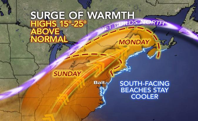
Wow! What an incredible way to start the weekend. Spring has definitely sprung. Remember those winter weeks when we couldn't buy a day above 32⁰ without snow? Well, our payoff comes Sunday with an almost summer-like Sunday in store. The official high temperature Saturday at the airport was 73⁰ and we hit that right around 2:46 p.m. We expect that we will be EVEN WARMER Sunday with high temperatures across the mid-Atlantic and much of the southeast soaring anywhere from 15⁰-25⁰ above normal. The normal, or 30-year average for Sunday is right around 64⁰... and we will be looking at highs near 80⁰ by Sunday afternoon. This is all courtesy of the jet stream building well to our north and southerly winds ushering in unseasonably mild air. We could see a bit of fog to start on Sunday morning as low level moisture increases overnight, but plenty of sunshine is expected by the afternoon.
Temperatures and dewpoints will be on the rise through Monday, and it will feel increasingly muggy with dewpoints rising from the low 40s Saturday to the middle 50s by Monday afternoon, but we expect to stay dry throughout the day. Then showers associated with a cold front are forecast to move in overnight, followed by widespread rain on Tuesday. A much cooler air mass will build in behind the front once rain tapers off Tuesday night. Sunshine will return through the end of the week, but temperatures will be well below normal on Wednesday, likely only topping out in the upper 50s by Wednesday afternoon.
Other Local News: