Maryland Drenched After Severe Storms Sweep Region
BALTIMORE (WJZ) --Severe thunderstorms, floods and even Tornado Warnings made for a very wet Saturday night.
A shortwave associated with Tropical Storm Bill arrived Saturday, bringing periods of heavier rain and thunderstorms across the entire area.
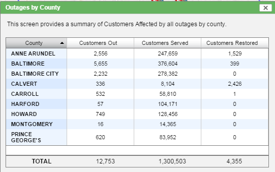
Rainfall between 1-2 is possible across the region by Sunday morning raising the warning for flooding in many locations. The storms also left thousands without power by 11:00 p.m. Saturday.
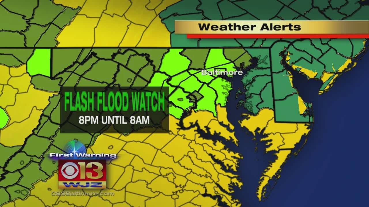
A severe thunderstorm watch, flash flood watch and flood watch are all in effect from Saturday night until Sunday morning. The storm is expected to be at its worst from 8 p.m. Saturday until 8 a.m. Sunday.
Temps Sunday will get into the lower 90s and with that along with the cold front approaching, we will have to be on the lookout for some afternoon and evening showers and storms. The cold front will pass Sunday night with a few showers and storms possible, but the real impact will be a lowering of the humidity.
Monday will be a very warm day with lots of sunshine as another cold front pushes into the Ohio Valley. Highs this day will get into the lower 90s again with not too much in the way of humidity (dew points in the lower 60s). That cold front will push into the region Tuesday with showers and thunderstorms.
Wednesday will still be warm behind the front (in the mid 80s) but it will be very comfortable with sunshine. This will continue right into Thursday, but there may be a few showers and storms as a warm front approaches the region. By Friday, an area of low pressure will approach from the west, bring the opportunity for some rain.
WATCH Tim Williams full First Warning Weather Forecast:
Track weather using our CBSBaltimore Weather App!