Powerful Nor'easter Will Hit Md., State Of Emergency For Eastern Shore
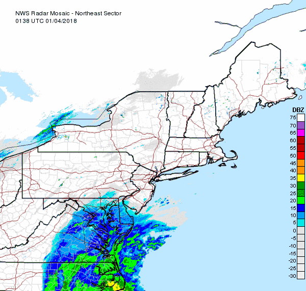
BALTIMORE (WJZ) -- As a powerful nor'easter is expected to bring snow, ice, rain, strong winds and rough surf to pretty much the entire east coast Wednesday into Thursday, a Blizzard Warning will be in effect for parts of Maryland's Eastern Shore.
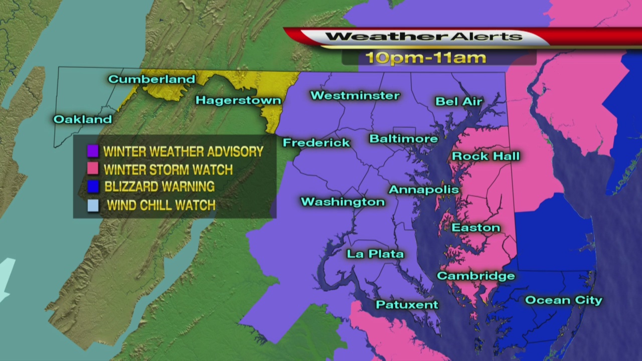
The warning covers Worcester County, Somerset County and Wicomico County. It begins at 7 p.m. and lasts through 1 p.m. Thursday. Heavy snow is expected, between 6 and 10 inches of accumulation and even up to 12 inches in some places, according to the National Weather Service.
The Maryland State Police, the State Highway Administration and local agencies have implemented the Snow Emergency Plan in Somerset County as of 9 p.m. Wednesday night.
Gov. Larry Hogan signed an executive order declaring a state of emergency in Somerset, Wicomico and Worcester Counties in anticipation of the snowfall.
"I urge all Lower Shore residents – and all Marylanders – to stay warm, stay safe, and avoid unnecessary travel. Freezing temperatures and heavy winds mean increased danger on our roads, even after the snow has stopped falling," Gov. Hogan said. "The state stands ready to offer any and all necessary resources to impacted counties."
A Winter Storm Warning, in effect from 7 p.m. Wednesday to 5 p.m. Thursday, covers most of the rest of Maryland's eastern shore -- Kent, Queen Anne's Talbot and Caroline counties. Between 4 and 7 inches of snow could be seen there.
A Winter Weather Advisory, in effect from 10 p.m. Wednesday to 11 a.m. Thursday, has been expanded to include all of central Maryland, including the Baltimore and D.C. metro areas. Just about 1 inch of snow is expected in those areas.
Central Maryland may see snow "if the low, the storm, hugs the coast," according to WJZ's Marty Bass. "Should it move further East we here in Charm City may see nothing...It is just a matter of looking for consistency in the modeling before a final storm total is laid out."
"Snow, mainly after 1 a.m.," says WJZ's Tim Williams. "Chance of precipitation is 90 percent. Total nighttime snow accumulation of around an inch possible."
The U.S. Coast Guard won't allow ships to enter the Port of Baltimore because of high winds expected in the winter storm.
RELATED: Coast Guard Won't Allow Ships To Enter Port Of Baltimore Due To Winter Storm
The Maryland Department of Transportation says the Coast Guard won't allow ships into the port from 6 p.m. Wednesday through Friday morning. Truckers who were scheduled to pick up shipments are urged to make other plans.
"We're watching it as it's coming up the coast if it shifts either way it could hug the coast it could push off, that's going to impact us one way or another," said Greg Slater of the MDOT/SHA.
Follow @CBSBaltimore on Twitter and like WJZ-TV | CBS Baltimore on Facebook