Maryland Weather: Tropical Storm Fay Forms; Flash Flood Watch For Parts Of Maryland
BALTIMORE (WJZ) -- As Tropical Storm Fay continues up the Eastern seaboard, parts of Maryland are under a flash flood watch due to the risk for some heavy rain.
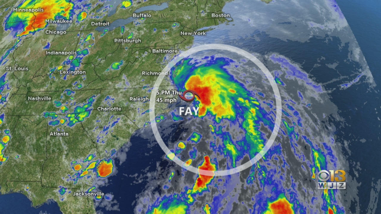
As of 5 p.m. Thursday, the National Hurricane Center said the tropical storm had formed off the coast of North Carolina. It was 195 miles south of Ocean City, Maryland, at the time.
Fay is the sixth named storm in the 2020 Atlantic hurricane season.
The flash flood watch, which includes Cecil County and much of the Eastern Shore, takes effect at midnight and runs into Friday. Rainfall totals could be between one and four inches, the National Weather Service said.
The low will slowly track northeast up the mid-Atlantic coast Thursday and Friday. There is still uncertainty about the exact track but more and more it's looking like the bulk of the rain will generally stay east of Maryland.
Possible impacts for Maryland include heavy rain east of Interstate 95 beginning Thursday night as well as gusty winds and dangerous surf along the coast.
In true July fashion, Maryland also has chances for afternoon pop-up thunderstorms over the next few days. Thanks to the low-pressure system, the best bet for that activity is Friday afternoon into the evening as the low tracks to the east.
Ahead of the storm, the Maryland Department of Transportation State Highway Administration said its crews have been checking inlets and drainage areas to make sure water can flow freely. They have also been making sure emergency response equipment is working and ready to go.
Stay up-to-date with the latest forecast by downloading the WJZ weather app.