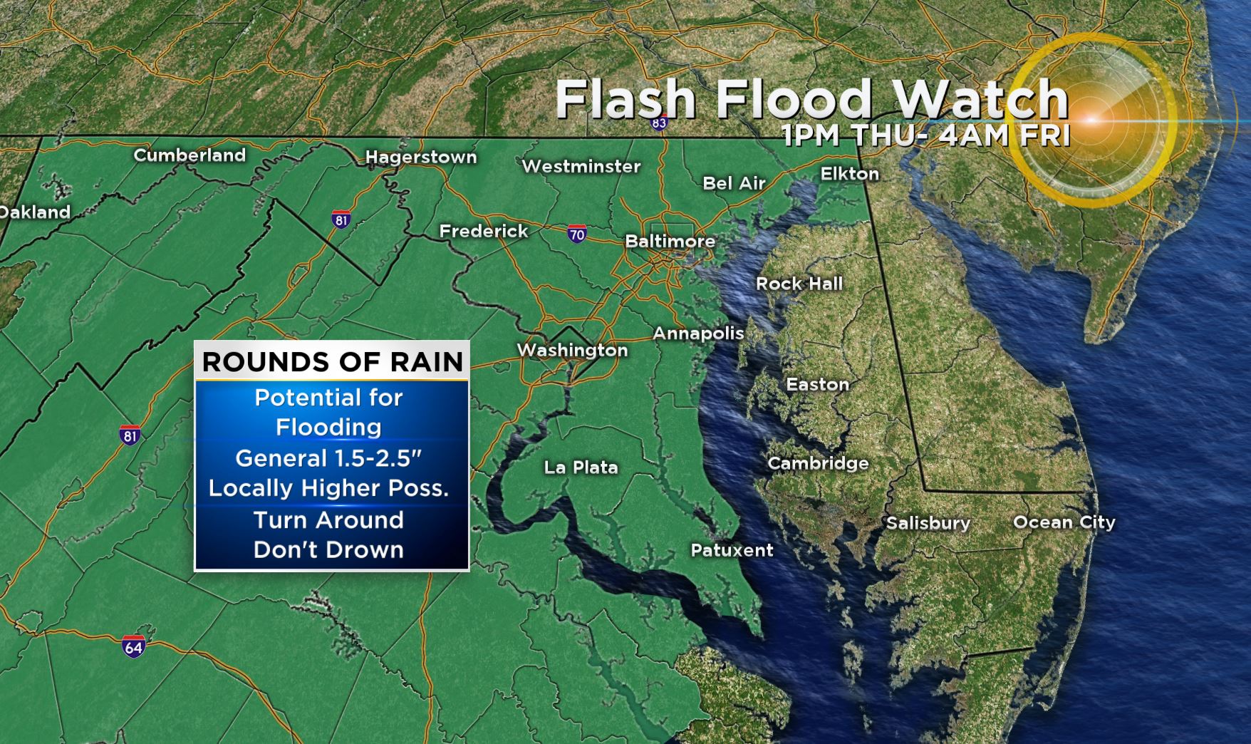
Maryland Weather: Flash Flood Watch In Effect For Christmas Eve; Damaging Winds, Isolated Tornadoes Possible
BALTIMORE (WJZ) -- A flash flood watch is in effect Thursday for most of Maryland as Santa and his reindeer prepare to visit for Christmas Eve.
The watch took effect at 1 p.m. Thursday and runs until 4 a.m. Friday for the following counties: Anne Arundel, Baltimore, Calvert, Carroll, Cecil, Charlies, Frederick, Harford, Howard, Montgomery, Prince George's and St. Mary's. Baltimore City is also a part of the watch.
In addition, a coastal flood warning is in effect for areas along the shore in Baltimore City as well as Anne Arundel and Baltimore counties until Friday morning.
Flood warnings are also in effect for several rivers and streams in parts of Carroll, Frederick, Montgomery and Washington counties.
What To Expect
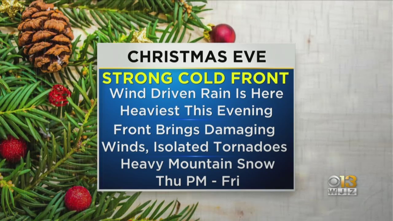
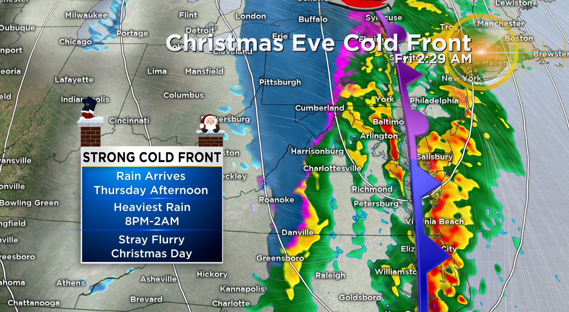
Rain moved into the Baltimore area Thursday afternoon. The strongest part of a cold front will push through Thursday night accompanied by gusty winds and heavy rain.
Rain amounts of 1.5-2.5" could lead to some localized flooding, especially in areas where snowpack is still present.
Crews in Baltimore are preparing for possible flooding. The city's transportation department is urging people in low-lying areas in Harbor East, Fells Point and Canton to move their vehicles to higher ground.
The Eden Street (501 S. Eden St.) and Caroline Street (805 S. Caroline St.) garages will be open from 5:30 p.m. Thursday through noon Friday for those who need a place to move their vehicles.
The strongest part of the system will impact the area through midnight in two waves.
The first wave, made up of moderate showers, moved through the Baltimore area Thursday evening, but the strongest winds remained south in St. Mary's and Calvert counties.
There will be a bit of a reprieve with generally light rain and even a dry period before the second potentially strong line of storms moves through closer to midnight, possibly packing damaging winds and isolated tornadoes.
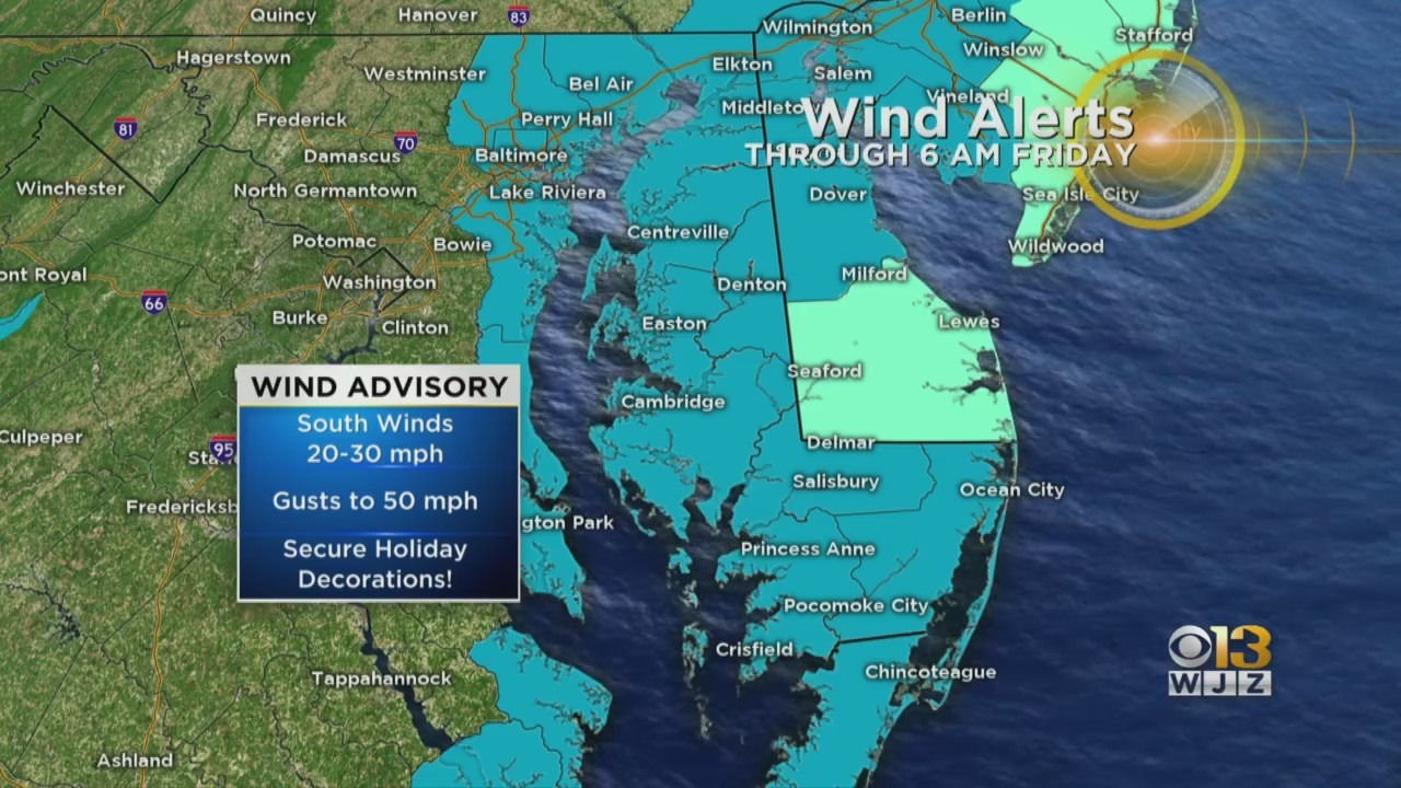
Winds could gust up to 50 miles per hour.
Wind advisories also took effect Thursday afternoon until Friday morning for the Eastern Shore and portions of Anne Arundel, Baltimore, Calvert, Cecil, Harford and St. Mary's counties as well as Baltimore City.
Models were indicating earlier in the week that a coating of snow would be possible on the back side of a strong cold front; however, this system is mainly going to be a rainmaker for central Maryland.
It looks like the best chance for a "White Christmas" will be in the mountains of far western Maryland. Heavy snow can be expected in portions of western Maryland throughout the holiday.
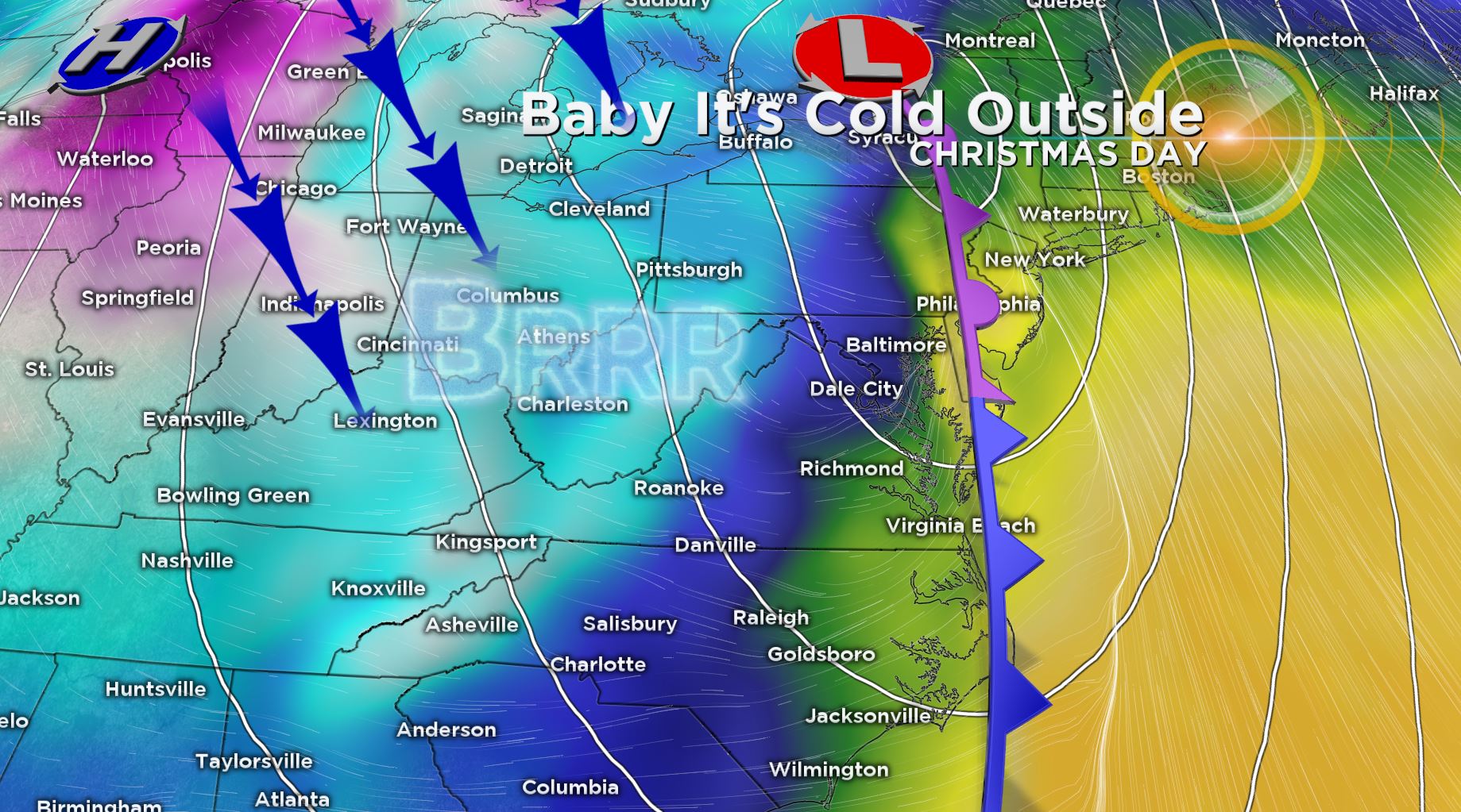
Temperatures Tumble
Temperatures topped out at 60 degrees at Baltimore-Washington International Thurgood Marshall Airport Thursday but will drop into the low 30s for the weekend.
Significantly colder air arrives behind the cold front, and temperatures are expected to tumble on Christmas Day. The forecast high is 40; however, we will likely fall into the low- to mid-30s by Christmas afternoon, and wind chills will make it feel like the teens!
Stay up-to-date with the latest forecast by downloading the WJZ weather app.