Weather Blog: More Winter Storms
Hi Everyone!
We are a bit beyond the halfway point of the month and starting another week that will feature two, potentially impactful, wintry events.
I want you to stay sharp tonight as steady rain will move up the I-95 corridor. That rain will be out a head of, and behind, a warm front that will raise our temps overnight from 32° at midnight.
Maryland Weather: Wintry Mix Moving In Monday Evening
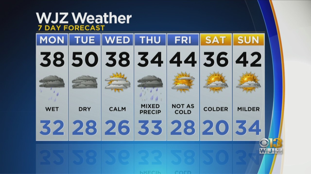
But we could see icing, or icy sports, before that warm up really kicks in tomorrow morning. Eventually a mild 50° tomorrow afternoon.
Weather does calm down tomorrow and Wednesday. But overnight Wednesday into Thursday another storm approaches that will bring us snow, turning to sleet, then to rain eventually.
With a forecast high Thursday of 34°, and low of 33° we are flirting with that 32° number all day and night. Not a lot of wiggle room there between problems and none. Beyond that we get the sun out for a few days in a row and get out of this gray chilly, at times raw weather pattern over the weekend.
A month from today we are into daylight savings time, and in a month and a few days Spring will do just that. But it's going seem like a ways off until we get through the above mentioned bumps in the Winter road.
MB!