There's More Snow On The Way. Here's What You Need To Know
BALTIMORE (WJZ) -- Here we go again! Another blast of winter weather is on the way.
A Winter Weather Advisory is in effect for most of Maryland from 9 p.m. Thursday until 5 a.m. Friday.
Moderate to heavy snow will move through overnight and impact our Friday morning commute, so plan for snow covered roads and slick conditions.
Most areas will see 2 to 4 inches of snow with some isolated areas picking up as many as 4 to 6 inches.
There is still a fair amount of uncertainty as for exactly who will pick up those higher totals.
So far, south of Baltimore towards D.C. and the top half of the Eastern Shore is shaping up to get the bulk of the heavier snow.
This is something the WJZ Weather Team will be monitoring closely, and we will let you know if we think adjustments need to be made.
Garrett County is under a Winter Storm Warning and could see between 4 to 8 inches of snow.
As for how we think this will play out, plan for snow spreading across the state from southwest to northeast, arriving in western Maryland by late afternoon.
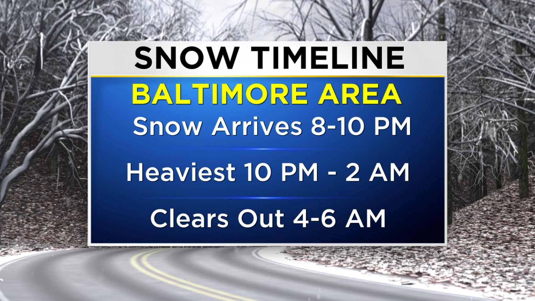
Snow should arrive in the Baltimore area between 8 p.m. to 10 p.m. Thursday.
Expect the heaviest snow to fall between 10 p.m. and 2 a.m. Snowfall rates of 1 inch an hour are likely in that window.
The snow should clear out between 4 a.m. and 6 a.m. Friday, creating challenging conditions for your commute.
Even if snow is no longer falling as you try to get to work or take the kids to school, you'll be dealing with the aftermath of slippery streets.
As meteorologist Meg McNamara noted, snow will leave slick spots on the roads. Between 10 p.m. and 3 p.m., visibility will be a half-mile or less.
Give yourself extra time to get where you need to go Friday morning, and if you don't have to be on the roads, consider avoiding them.
The rest of our Friday will be cold and blustery, with temperatures barely making it above freezing and wind chills in the teens and lower 20s.
Saturday's forecast is clear and cold with highs in the mid 30s.
Sunday is milder with afternoon temps reaching the mid 40s, but we'll also be dealing with a few showers.
Harshly cold air will settle in next week, with highs on Tuesday only in the upper 20s.