Maryland Weather: Bright & Mild Thursday, But We'll Cool Down Later On
BALTIMORE (WJZ) --- It's a generally quiet day, but we did have patchy freezing fog to start our Thursday.
That created some isolated icy pockets on the morning commute.
Bright skies are in store for the rest of our day.
It won't be solid sunshine, but it will certainly be an improvement from the very gray we dealt with Wednesday.
Seasonable temperatures are in store. The normal high for March 10 is 53° and we'll be just about there, topping out around 54°.
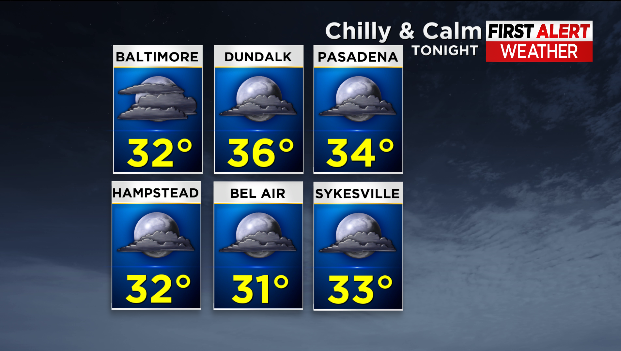
Thursday night will be seasonably chilly and calm, bottoming out in the low 30s with partly cloudy skies.
We wrap up the work week with mostly sunny skies on Friday and highs in near 60°.
Soak up that sunshine and calm weather because Saturday is a different story!
The WJZ First Alert Weather Team has declared Saturday an Alert Day.
A strong storm system will bring rain, snow, strong winds and frigid cold to the area. A strong cold front approaches Maryland Friday night causing rain to spread across the state overnight into Saturday morning.

Northwest winds will intensify behind this system, pulling in much colder air.
Temperatures in the 40s and 50s will plummet into the 20s and 30s causing the rain to change over to snow before the precipitation ends.
It looks like accumulating snow will be an issue for areas well north and west of Baltimore.
It's still too soon to narrow down totals because it's unclear how long the precipitation and freezing temperatures will line up.
A Winter Storm Watch is in effect for Garrett County where several inches of snow are possible.