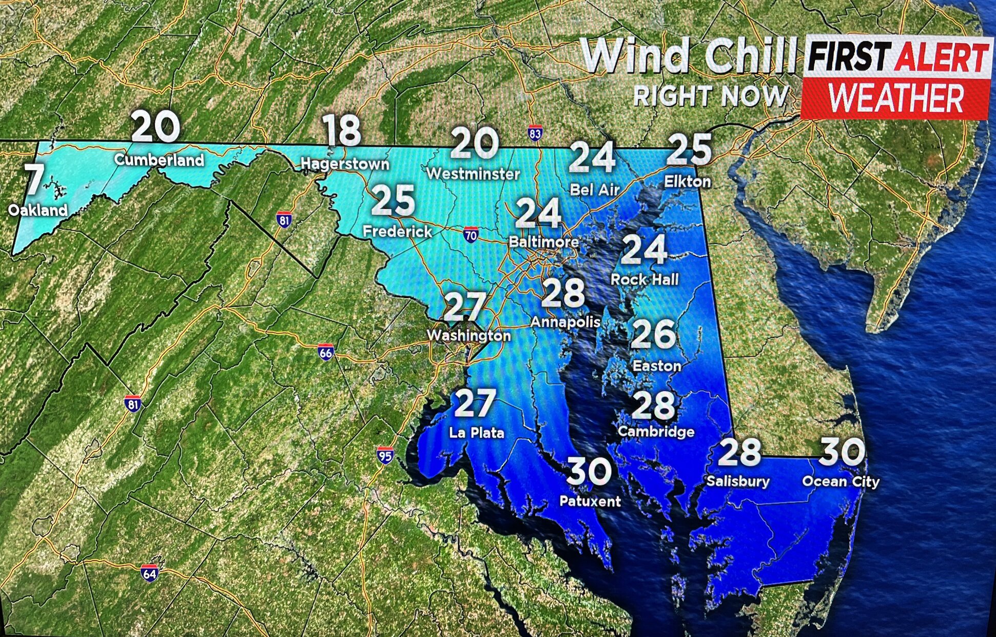
Artic Air Returns To The Baltimore Region
BALTIMORE (WJZ) -- A very cold Arctic air mass moved across the region on Sunday.
It created scattered flurries in some locations.
As a result, temperature highs only reached the low 40s and fell into the low 30s in the evening.
A hard freeze is in store for most areas overnight with the exception of the parts close to the bay and in downtown Baltimore.
The temperature highs will be in the upper 50s on Monday.
Most of the day will top out in the upper 30s to low 40s though.
The day will be accompanied by more sunshine but a cold breeze too.
On Monday night, there may be temperatures close to record lows in some areas.
A low of 21 degrees is forecasted for the area around BWI Thurgood Marshall Airport, which will be just 3 degrees above the record.
On Tuesday, some moderation on the temperature is expected to head this way followed by warmer air on Wednesday and especially Thursday.
The Baltimore area will get back to the 50s by mid-week.
Thursday may even see showers and hit the low 70s.
So this week we go from near-record January-like cold weather to mid-May—all within four days.
It's the constant battle of the seasons going on right in front of everyone's eyes.