Maryland Weather: Get Ready For The Next Storm System
BALTIMORE (WJZ) -- The rain on Sunday afternoon rapidly moved out of the area as a warm front lifted northward across Maryland.
As a result, temperatures were much warmer at night than they've been in the past. Projections indicate that they will remain mainly in the low 50s.
Expect a few lingering showers overnight but nothing significant.
Expect an early chance for showers Monday too. Otherwise, the Maryland area will be drier and warmer.
Temperature highs will rebound into the low to mid-70s by Monday afternoon.
More rain will arrive in Baltimore by Tuesday night as another storm system moves through the area.
Rain showers could make appearances on Wednesday too.
That storm system will depart by Wednesday night and another one will move in late Thursday and Friday.
Right now, it looks like the wettest and stormiest period will occur between Thursday night and early Saturday morning.
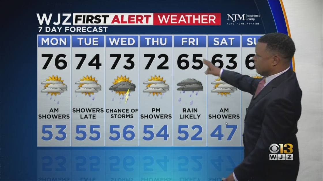
Temperatures throughout the week will remain warm with highs around 70 degrees to the mid-70s depending on sunshine or the presence of rain.
Slightly cooler weather will arrive later in the week and linger into the weekend.
But these temperatures are unlikely to be as cold as they've been in previous weeks.


