Snow Arrives, Winter Weather Advisory In Effect
BALTIMORE (WJZ) -- A winter weather advisory is in effect Friday evening through Saturday morning for the Baltimore metro region. A winter storm warning has been issued for Allegany and Washington counties.
Meteorologist Tim Williams reports that two potential storms are on their way this weekend.
The first arrived Friday night around 7 p.m. and will continue into Saturday morning, while the second will hit Sunday night into Monday. Both systems will be capable of bringing wintry precipitation to the region. The Sunday storm will make for a slick Monday morning commute.
Snow accumulations of 1 to 3 inches north and west of the I-95 corridor to the Mason-Dixon line are expected. It will begin as a wintry mix of snow and sleet Friday evening.
In the city, it will mix between rain and snow depending on how heavy the precipitation comes down--accumulation around an inch is expected.
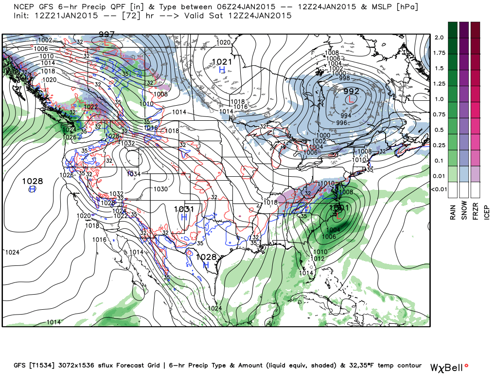
This is going to be a "fast-moving" coastal storm which will probably reach its "peak intensity" between midnight and 7-8 a.m.
Below is the GFS model precipitation type and sea level pressure valid Saturday morning at 7 a.m.
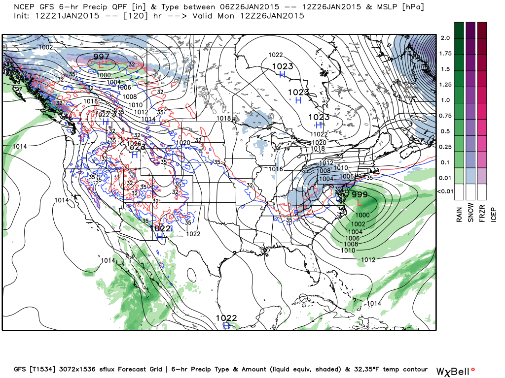
This next image is the GFS model precipitation type and sea level pressure valid Monday morning at 7am. For now, this system shows the potential for accumulating snowfall Sunday night into Monday.
Stay tuned to WJZ for First Warning Weather updates or download our weather app for the latest.