Weekend Weather: Cool Down Incoming, Hello Fall!
BALTIMORE (WJZ) -- It might be hard to imagine with the low 80s we're experiencing today but sweater weather is right around the corner!
Before we can get to that dramatic temperature drop, we have a high of 84° on deck for Friday and then a warm and humid Saturday with highs near 80°.
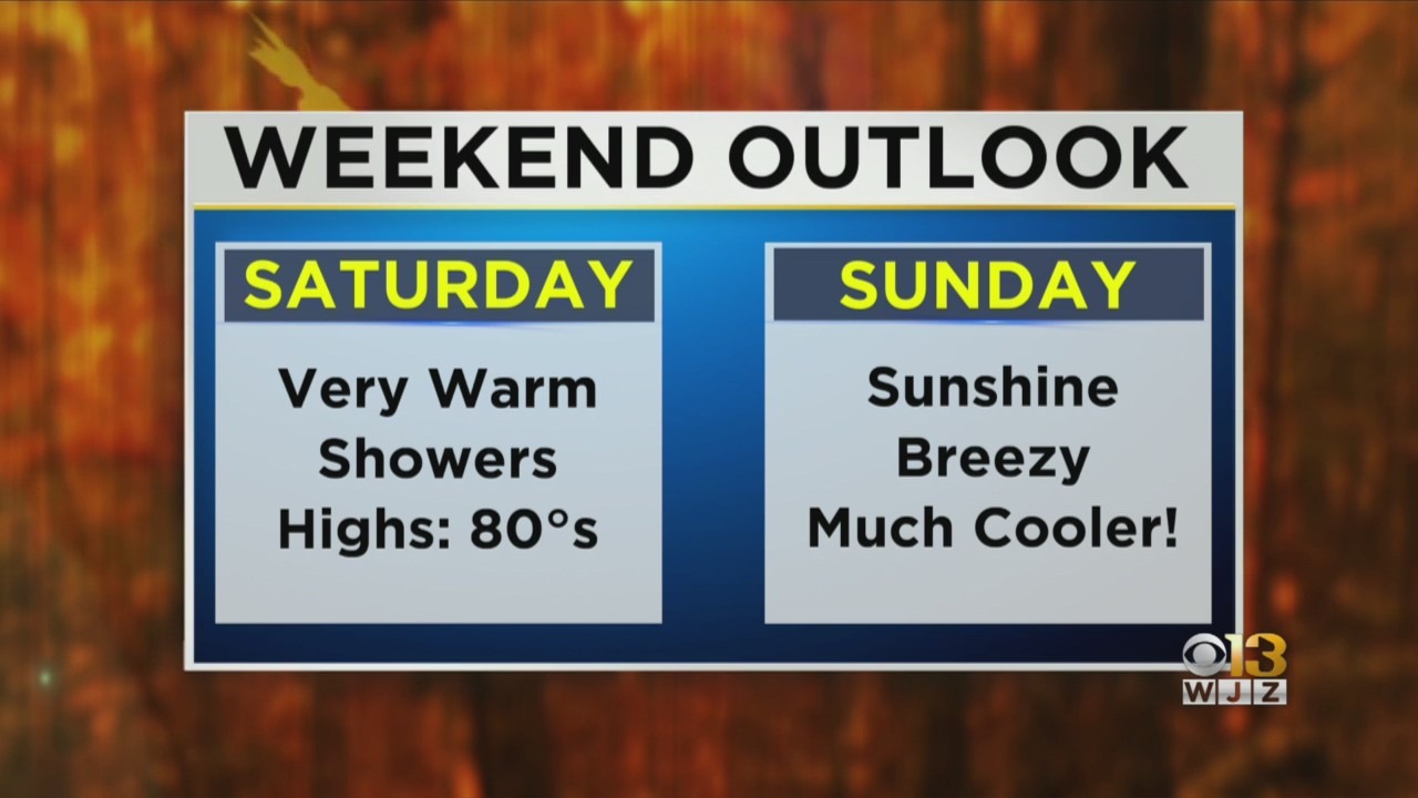
Saturday is when this cold front arrives so that does mean a good chance for showers and a few embedded thunderstorms during the second half of the day.
As far as the severe threat, we're expecting a marginal risk for severe storms. The primary threat will be wind gusts above 50 MPH.
This system could bring a few isolated downpours but most of us will pick up less than half an inch of rain.
This cold front will be more than capable of completely shifting the airmass in place from a warm and moist one to a dry and chilly one.
Highs on Sunday will only be in the mid-60s! Factor in a gusty north wind and the warmest it will actually feel is around 63°! That's a 20° drop from how it will feel the day before. Hello fall!
A large zone of high pressure will hold firm for most of the following work week, keeping things mostly to partly sunny and seasonably cool. Highs will range from the mid-60s into the low 70s.