Maryland Weather: A Brief Thaw Wednesday Before Snow Moves In
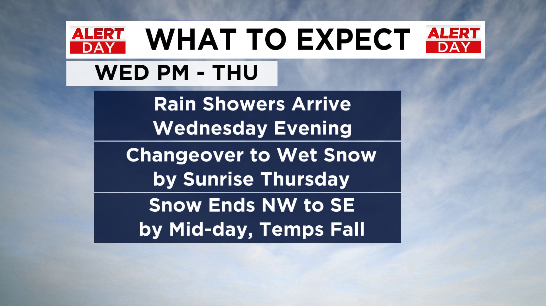
BALTIMORE (WJZ) -- A pleasant day is in store Wednesday as temperatures briefly thaw in the upper 40s by the afternoon. The thaw will be short-lived as another Arctic front moves east.
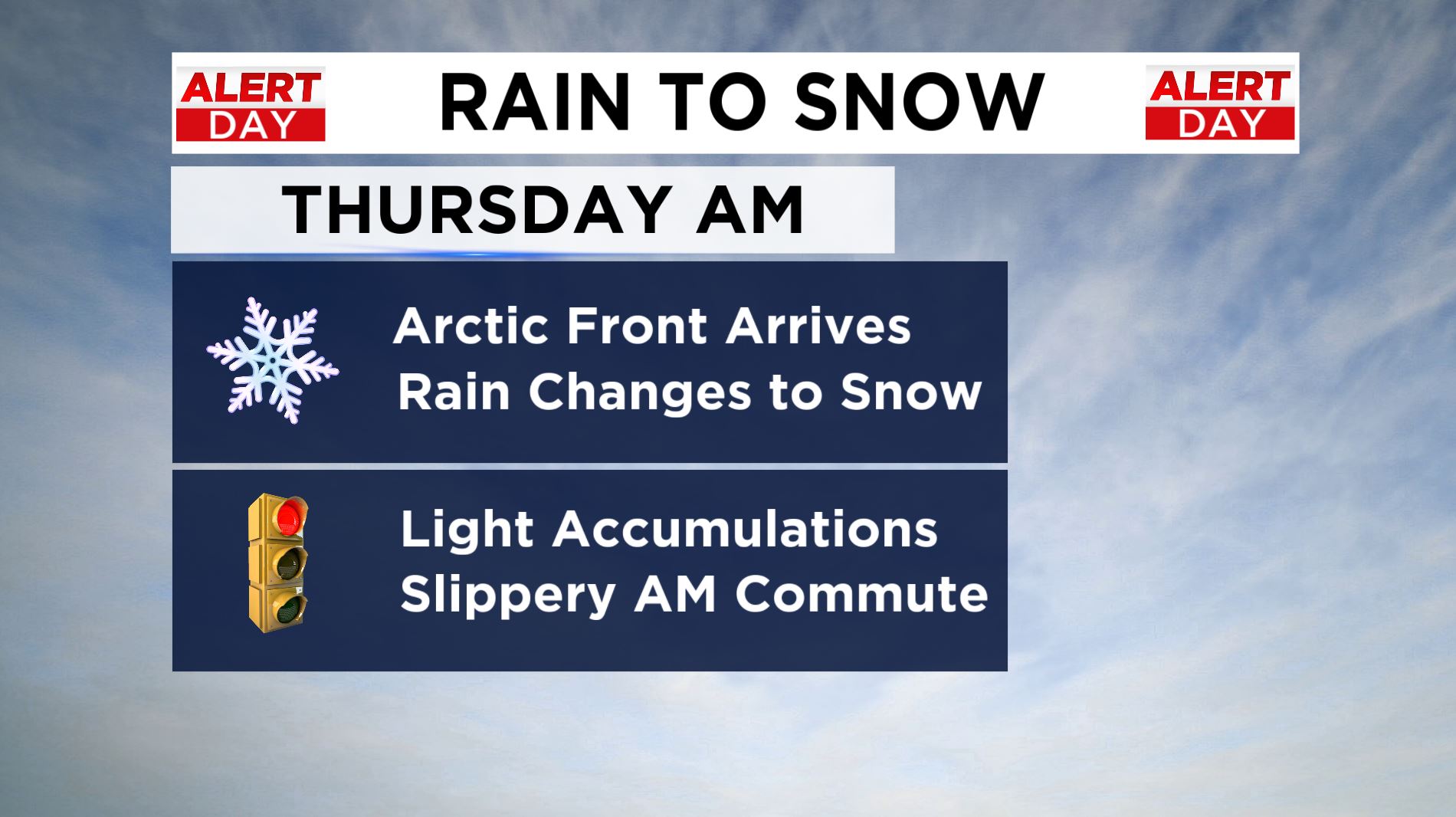
Much of Wednesday remains dry, clouds will increase at night and it's possible that a few rain showers break out during the evening and continue during the first half of the night. As Arctic air rushes in, rain will quickly change to wet snow and this will happen by sunrise Thursday, if not earlier.
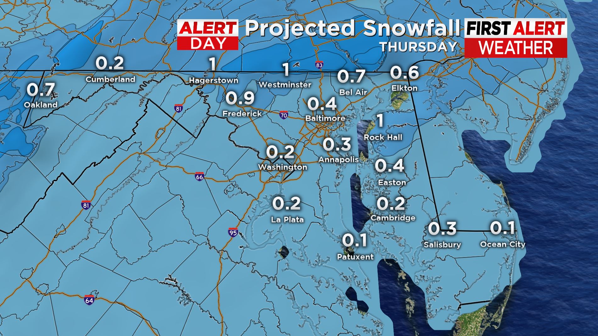
We are not expecting significant accumulations with this event, it is the timing during the morning commute that concerns the First Alert weather team. It will be difficult to pre-treat roads with rain arriving first, so if snow falls at a quick enough rate, this will likely lead to slippery conditions and of course reduced visibility.
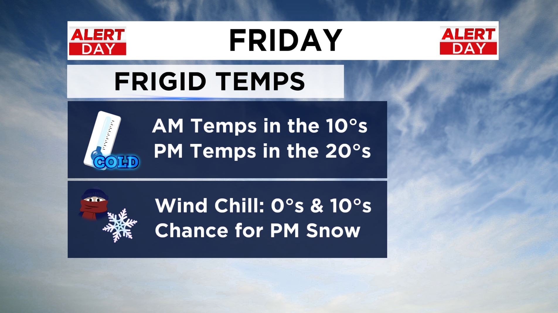
Any precipitation should clear out from NW to SE by midday and temperatures will be crashing behind the front.We have also issued an Alert Day for Friday with the return of frigid temperatures. Morning lows will be in the teens and daytime highs in the 20s. A blustery wind will make it feel like the single digits at times.
We are also still tracking the potential for snow at night. A nor'easter will try to form off the coast. Cold air will be in place, so any moisture that does arrive will be in the form of snow, however, modeling is trending toward a less impactful situation where the storm is too far east to bring any major accumulations by the weekend.
This could change, so please stay tuned for updates. Tomorrow we should have a really good idea of what the weekend has in store.
For now, we will focus on one even at a time. Regardless, we are in a very active winter weather pattern for the next couple of weeks.