Maryland Weather: Wind Chill To Bring Bitter Cold Friday
BALTIMORE (WJZ) -- The Arctic front was delayed in arriving this morning as we faced what had the potential to be an impactful event during the morning commute.
Fortunately, we were able to avoid this headache in central Maryland, and those who did see a brief changeover of rain to snow did not face significant problems. As this front pushes south and east, it will be stalling off the coast.
As a wave of low pressure develops along the front, a brush of snowfall for the lower Eastern Shore will be possible through Saturday. The highest snowfall totals will be along the coastline for places like Ocean City.
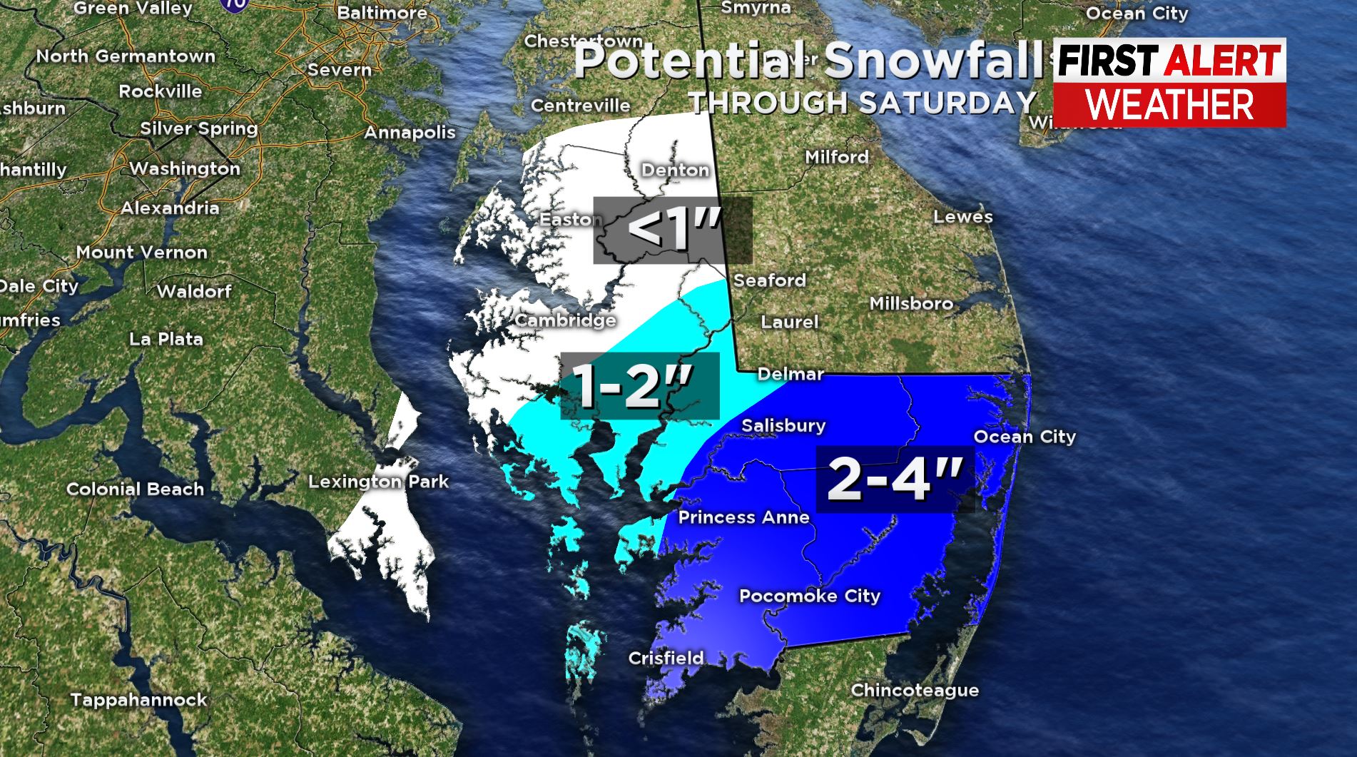
Between tonight and Saturday, it is possible that to boardwalk could pick up 2-4" of accumulating snowfall.
The bigger story for central Maryland is the Arctic Blast of air that is arriving behind this front.
As the cold air moves in tonight, the winds will as well. While some roads have dried out, any areas that remain wet will likely flash freeze as the thermometer drops. So isolated slick spots will be possible tonight for any areas that didn't get the chance to dry out.
Wind chill values will fall into the single digits tonight and tomorrow morning at the bus stop. This is why we have issued a WJZ Alert Day on Friday.
We recommend the full winter gear tomorrow, and not just in the morning... all day.
While forecast highs will be in the 20s on Friday, it will feel more like the teens all afternoon. Stay warm and stay with WJZ.
![]()