Maryland Weather: A Cold End To The Workweek, With A Winter Weather Advisory In Place For The Lower Eastern Shore
BALTIMORE (WJZ) -- It has been a cold end to the workweek in central Maryland, and even a slight wind made it feel much colder than the thermometer reading. Temperatures didn't make it out of the 20s all day, and it felt like the single digits as we woke up this morning.
 The cold continues, and some folks on the Eastern Shore will deal with accumulating snow on Friday night. Wind chills will fall into the single digits once again -- however, we did not issue a WJZ Alert Day for Saturday, simply because kids will not be waiting at the bus stop out in the cold.
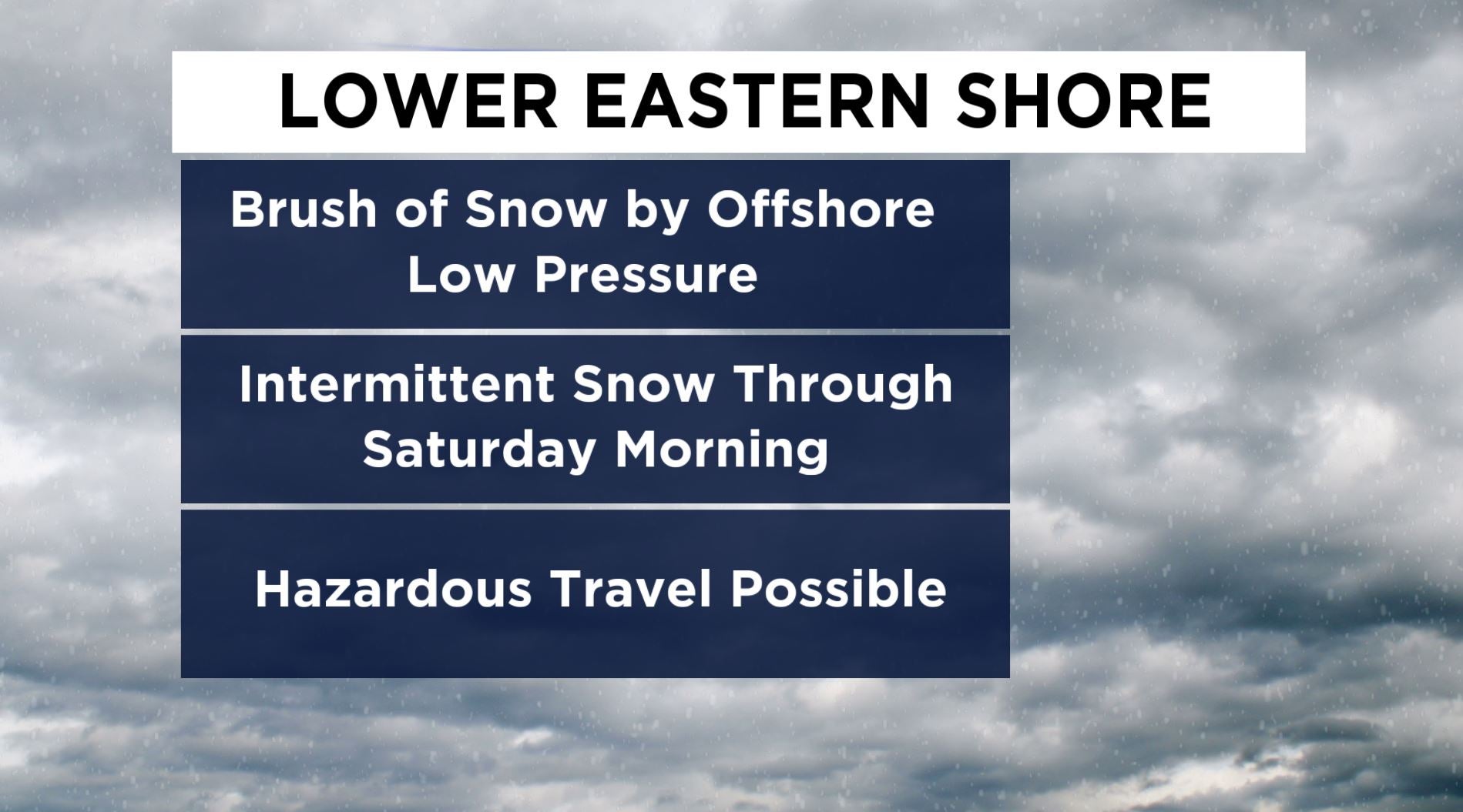
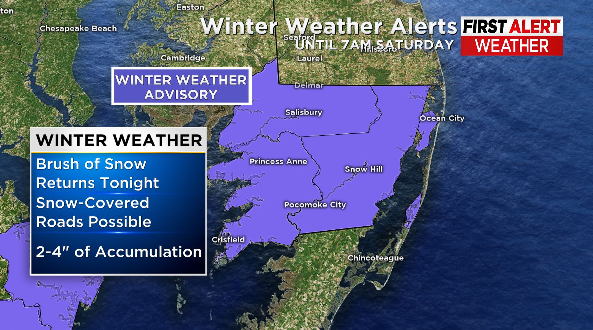
The front that brought this frigid air is stalled offshore and a developing area of low pressure will bring a brush of accumulating snowfall to the lower Eastern Shore tonight through Saturday morning. A Winter Weather Advisory is in effect for places like Salisbury, Ocean City, Snow Hill and Pocomoke City. An additional 2-4 inches of snow can be expected for these areas before this area of low pressure pulls away and travels out to sea. The Ocean City boardwalk is already snow-covered from yesterday's wave. Travel is likely to be hazardous tonight and Saturday morning in the lower Eastern Shore.
 Temperatures will only slightly moderate into the weekend, however they will remain below average for this time of year. The average high is in the lower 40s, but we area forecasting high temperatures in the 30s both Saturday and Sunday. Saturday afternoon will be less harsh as winds diminish and temps reach close to the freezing mark.