The Baltimore Area Will Soon See Storms And Freezing Temperatures
BALTIMORE (WJZ) -- Easterly winds brought light rain and very cool air from the Atlantic all across the region on Wednesday.
Rain amounts were generally under two-tenths of an inch as of 9 p.m.
There are some heavier areas of showers and perhaps some embedded thunder activity south and west of the region, which will roll through overnight and on Thursday.
A warm front is expected to move across the region, which will put most of the Baltimore area in a warmer and more unstable air mass on Thursday.
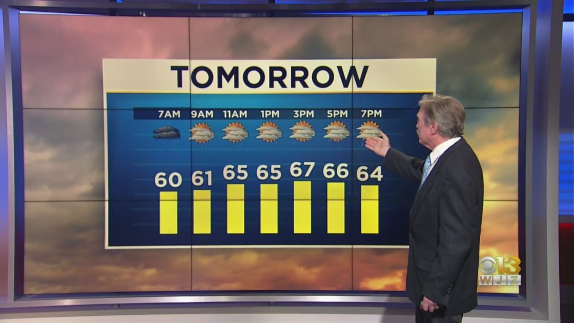
Temperatures could soar into the upper 60s again with a greater risk of more convective showers and some thunder.
The potential for severe storms is still expected to be in extreme southern Maryland and the lower Eastern Shore on Thursday.
The greatest risk will be some storms with damaging wind gusts.
A slow clearing will take place later Thursday and into Friday and cooler air mass will begin to move in as well.
Very chilly air will dominate this weekend and a shower is possible in the afternoon on Saturday.
Garrett County could even see some wet snow at that time.
Below freezing conditions will return on Sunday and Monday night as the weather drops back into the mid- to upper 20s!
Spring is going to have a tough time this weekend.