Alert Day: Flood Watch For Much Of Maryland As Rain Blankets The State
BALTIMORE (WJZ) -- Today is a WJZ Alert Day.
Rain is spreading across Maryland, with some pockets of moderate to heavy rain.
Heavy rain will become numerous during the second half of the day into tonight.
This is a very slow moving storm system that will have ample time to bring persistent wet weather.
A Flood Watch is in effect for much of the state through 2 a.m. Saturday.
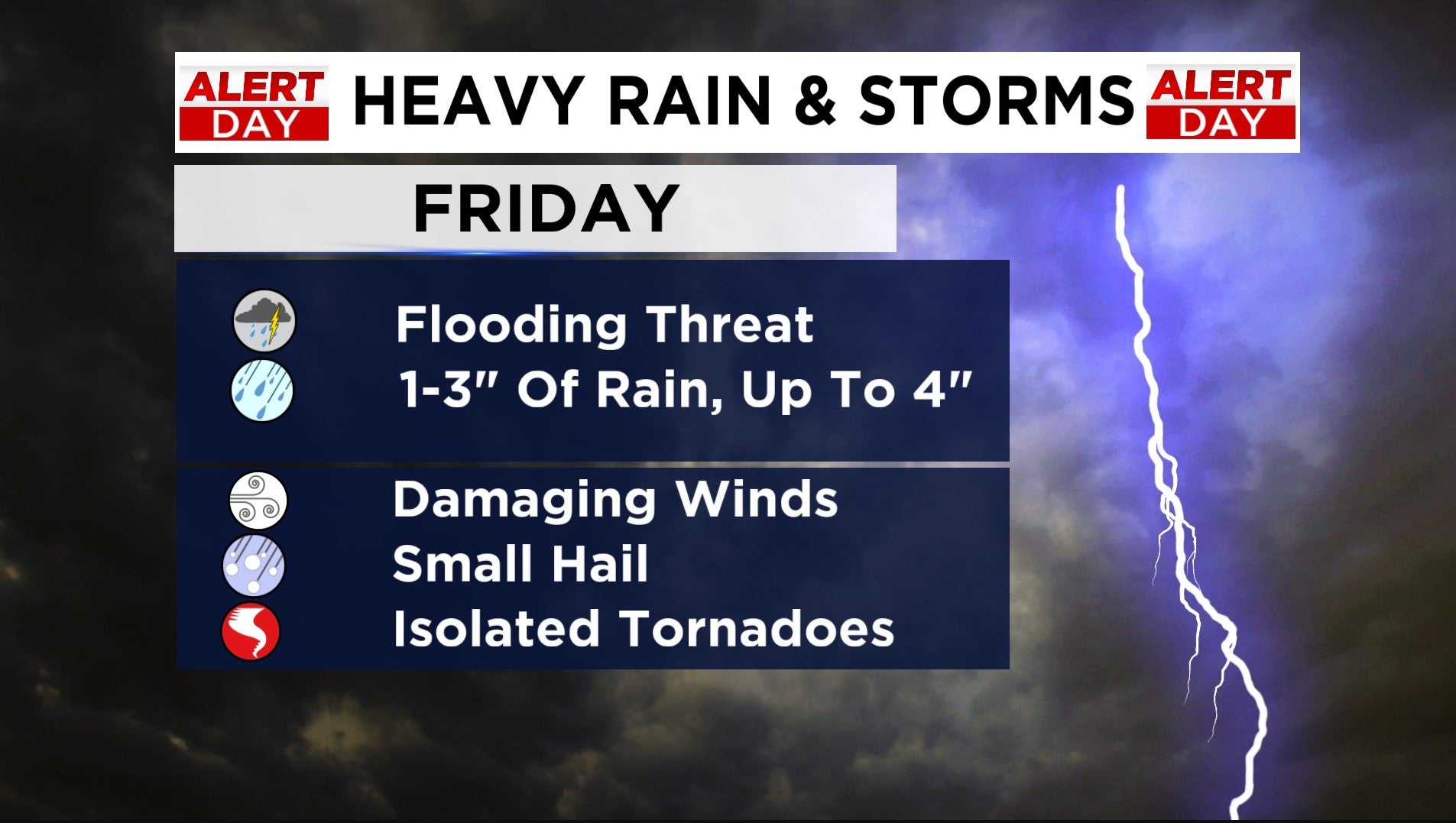
One to three inches of rain is expected, with some places getting closer to four inches.
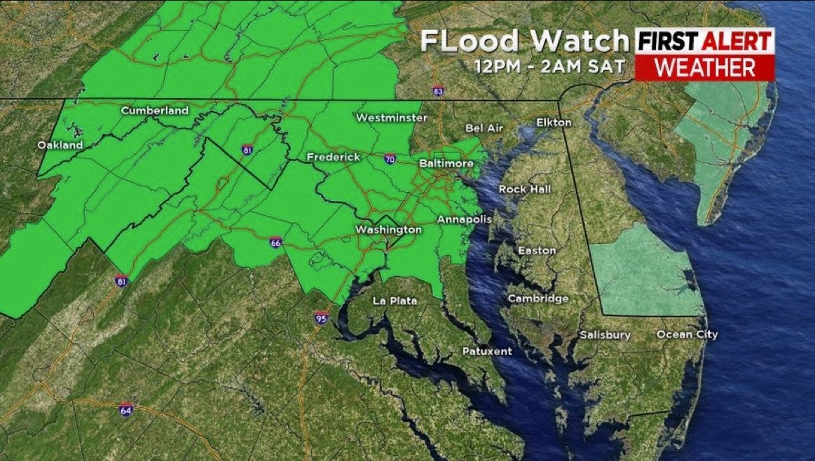
Drenching rain could lead to excessive runoff causing flooding of rivers and low-lying locations.
A severe weather threat also looms across Maryland Friday, particularly for southern parts of our state.
Damaging winds, small hail and an isolated tornado are possible.
The heaviest rain wraps up overnight with showers continuing through Saturday and even Mother's Day morning.
We are headed into a wet, chilly and blustery weekend.
Saturday is another WJZ Alert Day.
Thunderstorms continue to be a possibility in the morning with showers persisting through the day.
The harsh combo of temperatures and wind will make it a very cold day.
Highs will struggle to get out of the mid 50s, with northwest winds 15-20 mph and gusts up to 35 mph.
We lose the chance for thunderstorms by the second half of the weekend.
Keep the umbrella handy though because morning showers are still possible as you head out for a Mother's Day brunch.
Highs will only be in the low 50s, with winds continuing to be blustery out of the northwest.