Maryland Weather: Tracking Severe Storms Across Maryland
BALTIMORE (WJZ) -- An Alert Day is underway for Thursday afternoon into the night.
A strong cold front will track across Maryland, triggering strong to severe storms.
The National Weather Service issued a Severe Thunderstorm Warning for Somerset and Worcester counties until 8:30 p.m.
A Severe Thunderstorm Watch is in effect for much of eastern Maryland until 9 p.m.
A Severe Thunderstorm Watch for most of central Maryland and parts of western Maryland was canceled at 7 p.m.
The National Weather Service issued Severe Thunderstorm Warnings for several Maryland counties including Anne Arundel, Calvert, Caroline, Howard, Kent, Montgomery, Prince George's, Queen Anne's and Talbot counties, but all warnings expired by 6:30 p.m.
The Annapolis area saw heavy rain while under a Severe Thunderstorm warning around 5 p.m.
The watch covers Anne Arundel, Baltimore, Calvert, Caroline, Carroll, Cecil, Charles, Dorchester, Frederick, Harford, Howard, Kent, Montgomery, Prince George's, Queen Anne's, Somerset, St. Mary's, Talbot, Washington, Wicomico and Worcester counties, as well as Baltimore City.
A Flash Flood Watch is in place until 8 p.m. for many of those areas, including parts of Anne Arundel, Baltimore, Cecil, Harford, Howard, Montgomery and Prince George's counties, as well as Baltimore City.
A very hot and sticky airmass is in place, with midday temperatures already in the low 80s.
That's creating a very unstable atmosphere that's ripe for severe storms.
Some places will make a run at the mid to upper 80s before storms move in.
The Storm Prediction Center has placed most of Maryland under a slight risk for severe weather.
 Think of slight as a 2 out of 5 on the scale with 5 being the highest threat and 1 being the lowest.
Western Maryland is under a marginal risk, indicating a 1 out of 5 threat level.
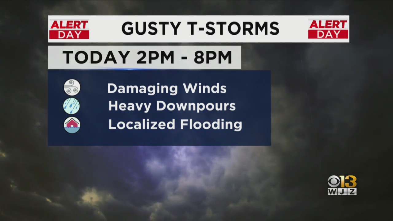
The main threat we're concerned about is damaging straight line winds.
The threat for tornadoes seems minimal.
These thunderstorms will likely produce very heavy and very quick-moving downpours that may trigger isolated flooding in the metro areas of Baltimore and DC.
Hail is also possible, but that threat is on the lower end.
The best window for strong to severe storms is from around 2 p.m. to 8 p.m.
The last bit of rain should clear out of here before midnight with clouds clearing out early Friday morning.
That means most of our Friday is shaping up to be sunny.
It will also be much cooler and much more comfortable, thanks to highs near 80 and low humidity.
Our weekend looks pretty wonderful as well, with those mostly sunny skies and highs near 80 sticking around.