WEATHER BLOG: Could We See More Storms?
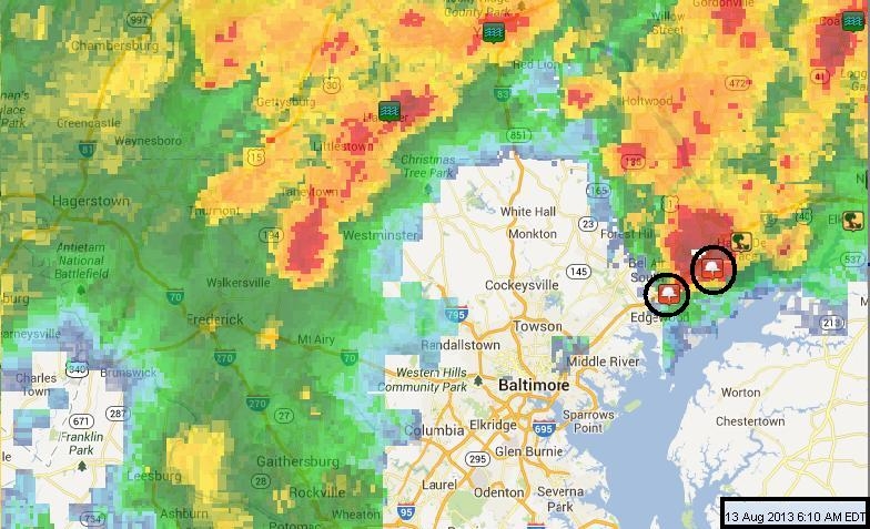
#mdwx: A cold front marched some rather intense weather into our neighborhood early Tuesday morning between 5 and 8 a.m. Spots that were hardest hit include Harford & Cecil counties in Maryland. Several tornado warnings, severe thunderstorm warnings and flash flood warnings were posted. Two funnel clouds were reported in Harford County, one near Aberdeen and another near Abingdon. No tornadoes have been confirmed at this time. The National Weather Service will be surveying damage to determine if any tornadoes touched down.
Although things have currently quieted down on radar, with the exception of a few residual showers located near the lower Eastern Shore, we aren't quite out of the woods just yet. But I feel confident that the "worst" is over for Tuesday. We could get a few more showers and t-storms to fire up Tuesday afternoon and evening, but they will not be as widespread as what we saw Tuesday morning. Areas more likely to see storms later Tuesday are southern Maryland and the Eastern Shore.
Here's the good news: once this cold front passes through, we are on track for a really nice and enjoyable forecast that will take us into the weekend with sunshine. High temps will settle into the upper 70s and low 80s for several days, dewpoints will be lower, and the air will feel less humid.
Hooray for better hair days!