CBS News Live
CBS News Baltimore: Local News, Weather & More
Watch CBS News
On Your Corner. In Your Corner.

Hundreds of first responders went into action within moments of the Key Bridge collapsing into the Patapsco River on March 26.
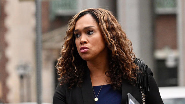
The lawyers representing former Baltimore State's Attorney Marilyn Mosby say she should not have to serve prison time, according to new court filings.
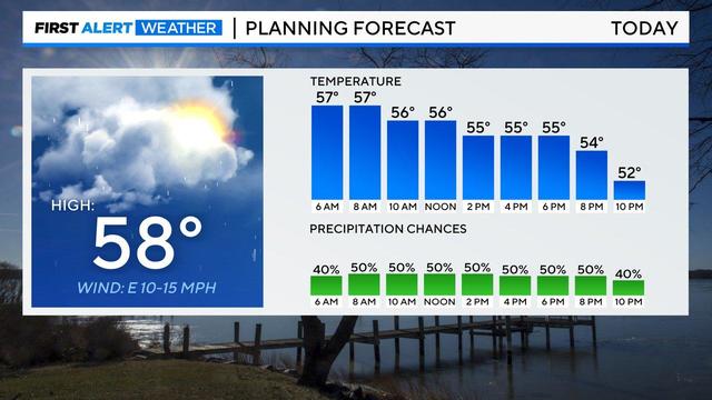
Off and on showers will continue for your Mother's Day weekend plans, but it will not be a washout.

Tensions are rising at Johns Hopkins University as pro-Palestine protesters remain despite repeated pleas from university administration for the encampment to end.

Ascension St. Agnes Hospital says it reacted quickly following a cyberattack on its computer systems that forced the facility to stop admitting new patients to the emergency room.

Michael Cohen's testimony in former President Donald Trump's criminal trial in New York suggests the prosecution is reaching the home stretch of its case.

Apple store workers in Towson, Maryland, made history in June 2022 when they voted to form the first union at one of the tech giant's sleek US stores. Now, they're weighing a strike.

Maryland Gov. Wes Moore has signed two measures into law to better protect personal data online from Big Tech.

The sunspot responsible for the odd series of strong solar flares is so big you can see it with your own eyes from Earth.

It wasn't clear last week how much Vignarajah would have to return due to the wording of Baltimore's public financing law,
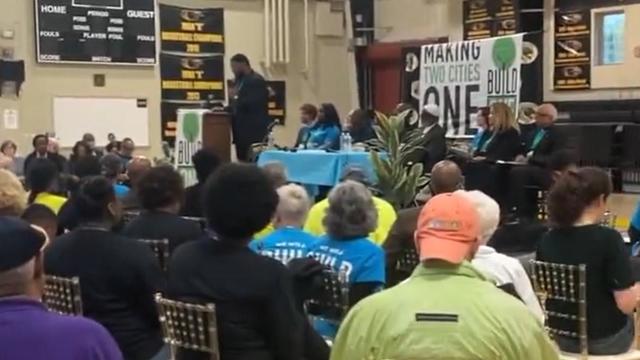
Dozens of community members attended the event at St. Frances Academy.
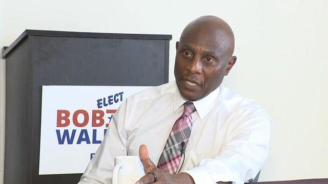
Maryland Primary Day is just weeks away and voters in Baltimore City will be making their voices heard in the race for mayor.

Maryland Transportation Authority has a solution to alleviate traffic congestion that has caused drivers headaches since the Francis Scott Key Bridge collapsed on March 26.

Engineers are rigging explosives to refloat the Dali, a cargo ship stuck in the Patapsco River since March when it crashed into the Francis Scott Key Bridge.

The body of a sixth construction worker was recovered from the Key Bridge wreckage site in Baltimore on Tuesday.

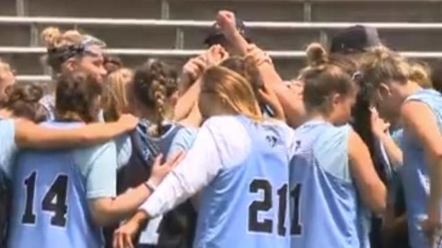
Postseason means a new season, a clean slate, for Towson lacrosse and their NCAA tourney opponent, Syracuse.

Craig Kimbrel was still in position to secure his ninth save of the season for the Baltimore Orioles and 426th of his career after he threw a fastball down the middle to Eddie Rosario.

Jorge Mateo drove in the go-ahead run with a 12th-inning single, and the Baltimore Orioles survived another shaky outing by closer Craig Kimbrel to beat the Washington Nationals 7-6.

Baltimore Ravens fans will soon know which teams we'll play when. The entire NFL schedule will be released at 8 p.m. on Wednesday, May 15.
Johns Hopkins practiced on Wednesday, getting ready for Friday's match against Fairfield at Yale.

Radebaugh florist has a Mother's Day collection based on the books mothers love to read their children
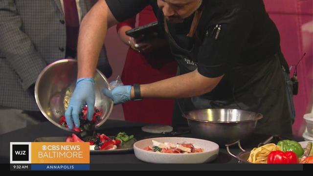
This Mother’s Day at all Crofton-based Titan Hospitality locations families can indulge in and treat their mothers’ and grandmothers’ to a delicious 3-course meal. But there are ways to celebrate at home, too
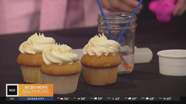
In this beginner-friendly class, participants will learn how to decorate from Duff’s team at Charm City Cakes and leave with their very own cake creations.

Meg Fox Aesthetics have services to have Moms looking and feeling their best including facials, laser treatments, and microneedling.

Take a look at some brunch cocktails that will be featured at The Tilted Row on Mother’s Day for the May 10th special.
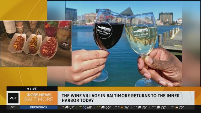
Preview the return of Baltimore's newest spring tradition and attraction! Wine Village in Baltimore returns to Inner Harbor from Mother's Day Weekend to Memorial Day.

Dr. Julia Shiner, Medical Director of Employee Health and Well-being at Erickson Senior Living, has some tips on how to stay healthy on the job.

There will be vendors, food trucks and entertainment in this celebration of furry friends

Island Quizine is opening a new location in Window Mill - with a delicious Caribbean food palette.

Charm City Picnic is Baltimore‘s newest way to enjoy those city skylines and good company.
Radebaugh florist has a Mother's Day collection based on the books mothers love to read their children
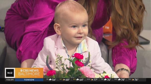
Teddy turns a year old in two weeks, and as Mother's Day approaches, Meg reflects on how her life has changed in the last year.

“I don’t want to just be thanked one day out of the year! I want that on random Wednesdays and Thursdays and whenever a tart is popped,” Leslie Gray Streeter writes in her latest column
This Mother’s Day at all Crofton-based Titan Hospitality locations families can indulge in and treat their mothers’ and grandmothers’ to a delicious 3-course meal. But there are ways to celebrate at home, too
Hundreds of first responders went into action within moments of the Key Bridge collapsing into the Patapsco River on March 26.
The lawyers representing former Baltimore State's Attorney Marilyn Mosby say she should not have to serve prison time, according to new court filings.
Off and on showers will continue for your Mother's Day weekend plans, but it will not be a washout.
Tensions are rising at Johns Hopkins University as pro-Palestine protesters remain despite repeated pleas from university administration for the encampment to end.
Ascension St. Agnes Hospital says it reacted quickly following a cyberattack on its computer systems that forced the facility to stop admitting new patients to the emergency room.
Apple store workers in Towson, Maryland, made history in June 2022 when they voted to form the first union at one of the tech giant's sleek US stores. Now, they're weighing a strike.
Maryland Gov. Wes Moore has signed two measures into law to better protect personal data online from Big Tech.
It wasn't clear last week how much Vignarajah would have to return due to the wording of Baltimore's public financing law,

The botched rollout of the new FAFSA form has resulted in a significant drop in completion rates, leaving many students uncertain about their college plans and financial aid.
Engineers are rigging explosives to refloat the Dali, a cargo ship stuck in the Patapsco River since March when it crashed into the Francis Scott Key Bridge.
Radebaugh florist has a Mother's Day collection based on the books mothers love to read their children
This Mother’s Day at all Crofton-based Titan Hospitality locations families can indulge in and treat their mothers’ and grandmothers’ to a delicious 3-course meal. But there are ways to celebrate at home, too
In this beginner-friendly class, participants will learn how to decorate from Duff’s team at Charm City Cakes and leave with their very own cake creations.
Meg Fox Aesthetics have services to have Moms looking and feeling their best including facials, laser treatments, and microneedling.
Take a look at some brunch cocktails that will be featured at The Tilted Row on Mother’s Day for the May 10th special.
Postseason means a new season, a clean slate, for Towson lacrosse and their NCAA tourney opponent, Syracuse.
Craig Kimbrel was still in position to secure his ninth save of the season for the Baltimore Orioles and 426th of his career after he threw a fastball down the middle to Eddie Rosario.
Jorge Mateo drove in the go-ahead run with a 12th-inning single, and the Baltimore Orioles survived another shaky outing by closer Craig Kimbrel to beat the Washington Nationals 7-6.
Baltimore Ravens fans will soon know which teams we'll play when. The entire NFL schedule will be released at 8 p.m. on Wednesday, May 15.
Johns Hopkins practiced on Wednesday, getting ready for Friday's match against Fairfield at Yale.
Michael Cohen's testimony in former President Donald Trump's criminal trial in New York suggests the prosecution is reaching the home stretch of its case.
Maryland Gov. Wes Moore has signed two measures into law to better protect personal data online from Big Tech.

Stormy Daniels gave defiant testimony Thursday as the defense accused her of fabricating details of the alleged sexual encounter between her and former President Donald Trump.
It wasn't clear last week how much Vignarajah would have to return due to the wording of Baltimore's public financing law,

In the five-page letter to President Biden, the NAACP detailed how it believes Mosby was unfairly targeted and unjustly convicted for perjury and mortgage fraud.

The theme of the race is "Monuments and Masterpieces." As usual, some parking restrictions and lane closures will be in place Saturday to accommodate the whacky race.
When it comes to vintage style, art and innovation—Baltimore is home to it all.

The University of Maryland Medical Center was granted the American Nurses Credentialing Center's (ANCC) Magnet for the fourth time in a row.

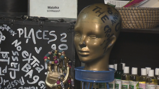
Magali Uroza comes from a Mexican immigrant family and remembers the challenges of learning English while growing up in Baltimore.

It is the cherry trees' second-earliest peak bloom on record and follows one of Washington's warmest recorded winters. In 1990, the trees blossomed on March 15.

The U.S. Drug Enforcement Administration is asking to move marijuana to Schedule III, alongside ketamine and some anabolic steroids
The Maryland Food Bank is on pace to distribute more than 52 million pounds of food, which is a 20 percent jump in comparison to pre-COVID times.

It has long been a popular resource in the community, easily accessible to many college students and neighbors.

Has mom and dad's bank been open too long at your house?

According to a report from the National Institute on Retirement Security, 40% of Gen Xers have zero dollars saved for retirement.
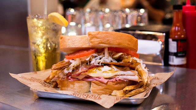
Primanti Bros. on Tuesday announced plans to expand to the Baltimore region this spring.

CVS is closing dozens of pharmacies inside Target stores in 2024 as the store and other retail pharmacy chains face increasing difficulties.

The wildly popular chicken finger joint opened its doors Tuesday at the Snowden River Shopping Center.
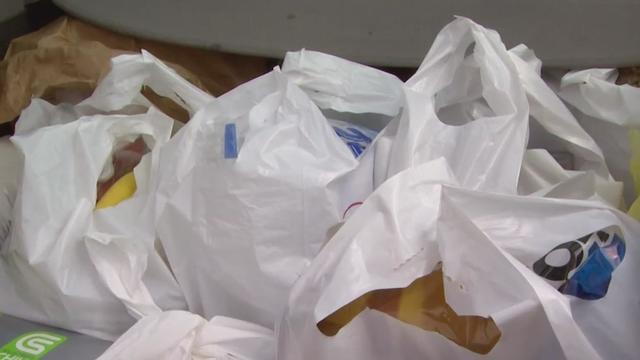
The council passed the "Bring Your Own Bag Act" with a bipartisan vote in February.
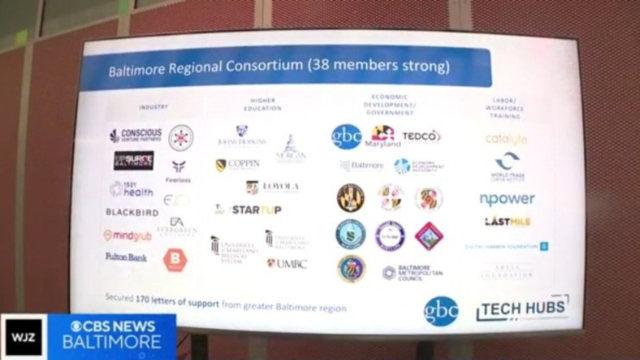
Baltimore is one of 31 designees announced Monday, picked from nearly 400 applicants.

Opioid addictions often start by having access to prescription medications.

Regular screenings are critical to identifying and treating cancer early. It's also important to be aware of any genetic mutations that already exist in your body.

Health officials are warning consumers not to consume Infinite Herbs basil sold at some Trader Joe's and Dierberg's stores after 12 people were sickened.

Most worrisome gaps involve cancer chemotherapy drugs, ER medications and and therapies for ADHD.

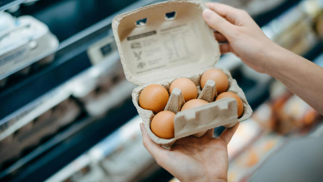
The prepackaged boxes of deli meat, cheese and crackers are not a healthy choice for kids, advocacy group says.

'Bob Hearts Abishola', the acclaimed comedy, is signing off after its fifth season on CBS.

"Sunday Morning" has an exclusive behind-the-scenes look at the creation of the country singer's first post-stroke song, "Where That Came From," which blends art with artificial intelligence in a recording that captures Travis' country heart.
The theme of the race is "Monuments and Masterpieces." As usual, some parking restrictions and lane closures will be in place Saturday to accommodate the whacky race.

The nine-time Grammy Award winner performs at CFG Bank Arena on Friday, October 4. It's her fourth stop on an 81-date world tour.

Rapper Busta Rhymes and funk rockers Morris Day and The Time are headlining the 47th annual AFRAM this year in Baltimore.
Wet weather will continue off and on into Mother's Day weekend, but it will not be a total washout for any plans.

We've made it to the end of the work week! I wish we could say we were celebrating with sunshine and 70s but instead we have a cool, damp and gray day.
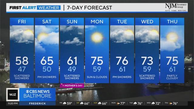
Off and on rain chances continue through Mother's Day

Severe weather threat has diminished across the area, but more showers are expected tonight through Friday.

Derek Beasley has your Thursday evening forecast (5/9/2024)
Charm City Picnic is Baltimore‘s newest way to enjoy those city skylines and good company.
Radebaugh florist has a Mother's Day collection based on the books mothers love to read their children
Teddy turns a year old in two weeks, and as Mother's Day approaches, Meg reflects on how her life has changed in the last year.
“I don’t want to just be thanked one day out of the year! I want that on random Wednesdays and Thursdays and whenever a tart is popped,” Leslie Gray Streeter writes in her latest column
This Mother’s Day at all Crofton-based Titan Hospitality locations families can indulge in and treat their mothers’ and grandmothers’ to a delicious 3-course meal. But there are ways to celebrate at home, too