Maryland Weather: Winter Storm Warning In Effect Sunday
BALTIMORE (WJZ) -- Here we go, Maryland. Another round of snow is heading our way!
Clouds will thicken Saturday night and conditions will deteriorate after midnight.
Fortunately, it is a weekend, which means many of us can enjoy a snow day and don't have to be worried about being out on the roads.
TIMELINE: Snow Likely In Parts Of Maryland Late Saturday, Sunday. Here's What To Expect
We are gearing up for our second nor'easter in less than a week as low pressure develops off the North Carolina coast overnight, but it will be very different.
This particular storm will not last nearly as long as the last, so let's talk about timing.
Precipitation will begin to move in from the south between 2 a.m. and 4 a.m. early Sunday. It could briefly start as rain but then transition to snowfall easily by 7 a.m.
The heaviest snow will likely fall between 7 a.m. and noon as banding will likely develop during this time. As the afternoon wears on, snow will taper from west to east and should be out of here by 4 p.m.
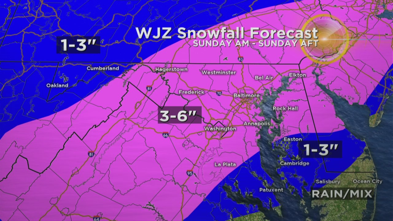
A general 3-6" of snow can be expected, based off strong forcing in the atmosphere.
The highest snowfall accumulations will be directly correlated to where snowfall banding sets up and the WJZ weather team will be monitoring this throughout the day.
Temperatures are expected to rise above freezing Sunday afternoon with a high around 40, so this will be beneficial for melting, prior to sunset. But, once temps fall Sunday night, and it will happen quickly, anything that melts throughout the afternoon will likely freeze, resulting in icy conditions.
Ahead of the system's arrival, the National Weather Service issued winter storm warnings and advisories for much of Maryland.

Stay up-to-date with the latest forecast by downloading the WJZ weather app.