Significant Icing Reported In Areas South Of Baltimore Overnight
BALTIMORE (WJZ) -- Icy roads will be a big issue for drivers overnight and Sunday morning after a wintry mixed moved through the region Saturday.
Significant icing was reported in areas south of Baltimore. For example, in a report for Crofton, Maryland, 0.25" of ice accretion. Elkridge saw 0.20" of ice accretion, while Edgemere recorded 0.15".
Columbia reported 0.13", while Forest Hill had 0.05".
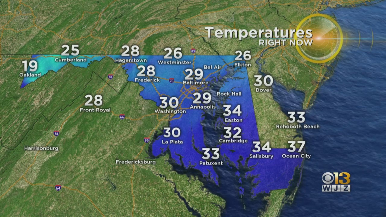
Expect icy conditions Sunday morning, with overnight lows dropping into the 20s.
Sunday, February 14, 2021: Drier conditions will prevail for Valentine's Day, however, the skies will remain mostly cloudy.
Temperatures Sunday afternoon are expected to rise above freezing, so that should help with some melting!
Winter weather advisories and ice storm warnings remain in effect for parts of the region through 7 a.m. Sunday.
The system prompted the National Weather Service to issue a Winter Weather Advisory for: Anne Arundel, southern Baltimore, Calvert, Charles, Cecil, southern Harford, Howard, Montgomery, Prince George's and St. Mary's counties beginning Saturday morning through Sunday morning. Baltimore City is also included in the advisory.
In addition, Charles and St. Mary's counties are under an ice storm warning until 7 a.m. Sunday. Ice accumulations in those areas could exceed a quarter of an inch.
Stay up-to-date with the latest forecast by downloading the WJZ weather app.