Maryland Weather: EF-1 Tornado Touched Down In Cecil County Monday
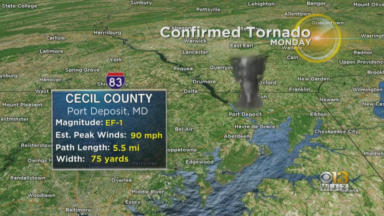
PORT DEPOSIT, Md. (WJZ) -- An EF-1 tornado with winds estimated at 90 miles per hour touched down in Cecil County on Monday, the National Weather Service confirmed Tuesday.
The tornado was on the ground for roughly five minutes in the Port Deposit area. During that time, the 75-yard-wide twister covered a path of 5.5 miles. Portions of Harford and Cecil counties were under a tornado warning at the time the tornado touched down around 2:37 p.m.
The National Weather Service reported the tornado, while short-lived, lifted a roof deck, caused a chimney to collapse and uprooted trees.
No injuries or deaths were reported.

Much of the state was under a tornado watch for part of Monday as a line of thunderstorms moved across the area, bringing heavy rain and flooding. At Baltimore-Washington International Thurgood Marshall Airport, 2.74 inches of rain fell Monday, breaking the previous single-day precipitation record for Baltimore on November 30 of 1.19 inches set back in 1967.
The heavy rain also led to several water rescues in Baltimore.
An EF-0 tornado also touched down in Montgomeryville, Pennsylvania, about 20 miles north of Philadelphia. That storm damaged homes and office buildings in the area, CBS Philly reports.
Stay up-to-date with the latest forecast by downloading the WJZ weather app.