TIMELINE | When And Where To Expect Severe Storms In Maryland Tuesday
BALTIMORE (WJZ) -- Severe storms are possible Tuesday afternoon in parts of Maryland.
The focus of the strongest storms shifted south of Baltimore, but drenching downpours are possible in our area. Damaging winds, hail and a few tornadoes are possible in areas south of DC and southern Maryland.
"Great news for Marylanders, the weather is looking less and less volatile this Tuesday. The Storm Prediction Center has downgraded our areas to the "Marginal Risk" category for severe storms, meaning an isolated t-storms can't be ruled out. The best chance for severe weather will be for areas like southern Maryland and northern Virginia," Meteorologist Chelsea Ingram said.
RELATED STORIES:
- Maryland Weather: Severe Storms Possible Tuesday In Parts Of State
- Baltimore, DC Rank 2nd Highest In The Nation For Severe Storms This Year
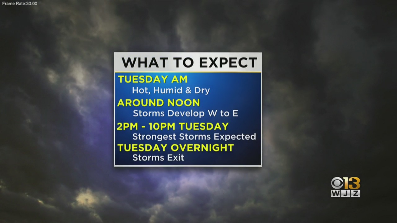
Here's the timeline when you should expect the storm to roll through Maryland.
- Noon -- A shower or thunderstorm will begin to pop up.
- By 2 p.m. -- The storms will really start to bubble up and strengthen just in time for the evening commute. Damaging winds can be expected in Southern Maryland.
- By 10 p.m. -- The storm will finally quiet down through the overnight hours.
There's also a potential for storms to rotate -- meaning there could be a couple of tornadoes that develop.
Baltimore and DC have had a significant number of severe thunderstorm warnings this year -- ranking 2nd highest nationwide behind Oklahoma with 524 severe storms, according to Iowa State University's data.
As long as you are safe, we'd love to see your photos and video of storm damage. Email newsroom@wjz.com or use #BeOnWJZ.
Stay up-to-date with the latest forecast by downloading the WJZ weather app.